- Details
- Hits: 423
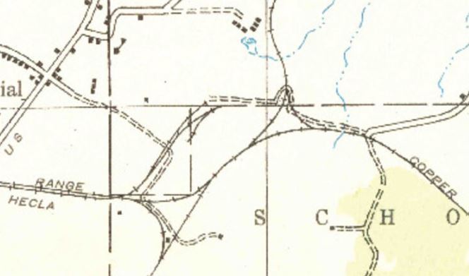
Location: Calumet Junction, MI (Houghton County)

Photo info: This is a USGS map of Calumet Junction around 1938. [USSGS]
Notes
Time Line
1903. The Copper Range railroad builds a 16' x 24' water tower here. The tank is filled by a steam-powered pump.
1933. The Copper Range railroad noted a water tank at this location, including a telephone. They also had a telephone in the section house here. [ETT-COPR-1933]
Bibliography
The following sources are utilized in this website. [SOURCE-YEAR-MMDD-PG]:
- [AAB| = All Aboard!, by Willis Dunbar, Eerdmans Publishing, Grand Rapids ©1969.
- [AAN] = Alpena Argus newspaper.
- [AARQJ] = American Association of Railroads Quiz Jr. pamphlet. © 1956
- [AATHA] = Ann Arbor Railroad Technical and Historical Association newsletter "The Double A"
- [AB] = Information provided at Michigan History Conference from Andrew Bailey, Port Huron, MI

