Manistee River Bridge, Manistee, MI - (CSX) ♦ ♣
- Details
- Hits: 5911

 Location: Manistee River, Bridge, Manistee, MI - (CSX)
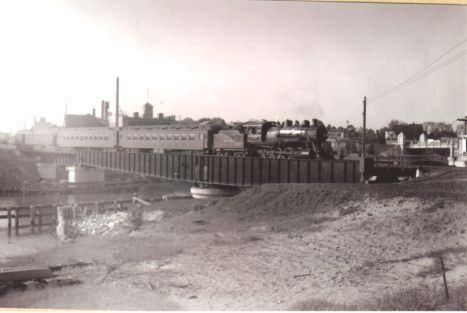
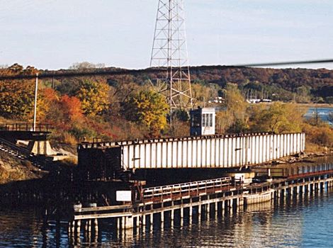
This swing bridge brings the CSX over the Manistee River on the north end of town. The tender shack is an old Manistee & Northeastern caboose #5 (enclosed in siding). The bridge was built by the Manistee & Northeastern in 1889 and rebuilt by them in 1899. They were the original owner. The original length of the draw span was 160 feet. It was a wood and iron Howe truss, 12 feet above the water line (which was 14 feet deep). The bridge was originally swung by hand power. The bridge was protected by a Gravitt (interlocking) semaphore and derail. [MCR-1904]
Photo info: Top, M&NE 325 pulls a passenger train across the Manistee swing bridge. [Charles Showalter collection]. Bottom, CSX Manistee Swing Bridge in 2001. [Tim Shanahan]
Notes
Time Line
1889. The bridge is built, then rebuilt in 1899.
1928. High waters rushing at seven mph down the Manistee river caused the skipper of the PM steamer Virginia to lose control of his ship and the harbor was blocked for more than nine hours. The ship swerved just as it was entering a railway drawbridge and lodged crosswise in the channel. Seven hours later her companion ship, the Nevada, arrived from Milwaukee and after a two-hour battle, extricated the Virginia.
Docks of the Manistee Iron works were destroyed and several thousand dollars in iron and steel slipped into the river. Later, the Nevada plunged into the Maple street bridge and caused considerable damage to the south half of the lift. The Manistee river is the highest it has been in many years and high waters in rivers and streams is causing trouble. Section hands at Wellston were called out to break log jams in the Little Manistee river, 25 miles east of Manistee when bridges were threatened.
Workmen saved the Everson bridge over Bear Creek on the Kaleva road by placing sandbags about the weakened abutments. [DFP-1928-0410]
1941. This bridge, which was operated by the M&NE, was an interlocking. Derails and fixed semaphore signals were located 250 feet north and south of the drawbridge. The signals were two-arm semaphores governing movement over the bridge. [M&NE ETT 1941]
Bibliography
The following sources are utilized in this website. [SOURCE-YEAR-MMDD-PG]:
- [AAB| = All Aboard!, by Willis Dunbar, Eerdmans Publishing, Grand Rapids ©1969.
- [AAN] = Alpena Argus newspaper.
- [AARQJ] = American Association of Railroads Quiz Jr. pamphlet. © 1956
- [AATHA] = Ann Arbor Railroad Technical and Historical Association newsletter "The Double A"
- [AB] = Information provided at Michigan History Conference from Andrew Bailey, Port Huron, MI

