- Details
- Hits: 2865
Mine: Riverton Group Mines, Stambaugh, MI
Iron River Mine → Riverton Group Mine → Hiawatha No. 2 Mine
Operated for 55 years.
From: 1882
Location: Riverton Mine (E 1/2-NE Section 35) and Iron River Mine (NW-NW Sec. 36 of T43N-R35W0; the Dober Mine (NW Sec. 1); the Duff Mine (E 1/2-NE Section 2 of T42N-R35W); the Isabella (SW-SW Section 36 of T43N-R35W). The Dober, Duff and Isabella are now part of the Hiawatha No. 2 mine.
Owned by: Oliver Iron Mining Co.
Produced: Iron Ore, soft, brown, high phosphorus and manganiferous.
Method: Underground. Depth 1,750 feet.
Railroad connection: C&NW to Port of Escanaba.
Until: 1937
Lifetime Production: 5,881,550 tons between 1882 and 1937.
 Notes
Notes
Formerly Iron River Mine.
Leases on Dober, Duff and Isabella surrendered in 1933 and new leases taken by the M.A. Hanna Co. to form the Hiawatha No. 2 mine which has shipped since 1935. [LSIO]
Mine is apparently under the Iron River.
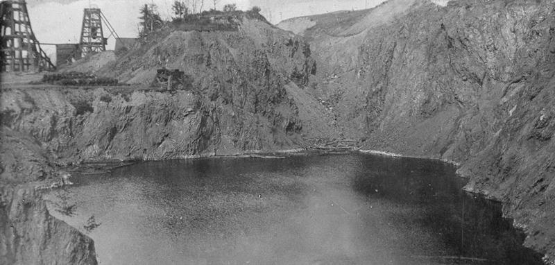
Photo info: The mine pit, filled with water, after production had stopped. Note the nearby mining equipment. [MINART]
Time Line
1899. May. The bailing out of water in shafts 3 and 5 at the Riverton mine has been progressing as satisfactorily as could be expected. The water in the shafts has gone down over 100 feet and in the open pit about five feet. From the time the bailers were started to work on the 23rd up to the present time they have been almost constantly operating. The bailer in #3 is the largest; it lifts every trip nearly four and 1/2 tons of water. The one in #5 shaft lifts over two and 1/2 tons of water. The two bailers made bout 1,500 trips every 24 hours, which gives an indication of the large volume of water that is being lifted daily.
1901. Mine owners (Oliver) and village officials consider changing the course of the Iron River (through the city), which flows over the Riverton mine at Stambaugh. The Miller Mine is also affected, which adjoins to the north. The Miller is not worked at the present time with ore being taken out of the Iron River mine. Of the routes surveyed for the river, one crosses to the west of Iron River village connecting with the river again through a gully away to the south of the mine. A large cut will be necessary to turn the water through this channel. A route east of Stambaugh hill through Ice Lake has also be talked of. This would be expensive as the one to the west of the village but would take the water further away from the mine. The Oliver company also had the thought of running a rock tunnel through the great hill on the foot side of the vein. [DD-1901-0427]

